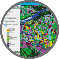
One of the results of the LIFE Eau&Climat project, the study carried out by the SMAVD on the mapping of irrigated areas in the Durance using remote sensing, will be presented at the Journée Télédétection - Le spatial, rampe de lancement de l'aide à la décision territoriale. This event, organised by the Data Terra Sud regional coordination body, will be held remotely on Friday 8 November.
Remote sensing from space provides access to data, tools and services that help to facilitate territorial management. The aim of the Remote Sensing Day - Space, a launch pad for regional decision-making, is to gain a better understanding of the space ecosystem in the regions and territories, and to open up the field of possibilities. The event will be held remotely on Friday 8 November and is aimed at project owners, project managers, geomaticians, students, etc. It is organised by the Data Terra Sud regional coordination group, led by CRIGE PACA and GeographR, the Université Côte d'Azur, the French Ministry for Ecological Transition, Energy, Climate and Risk Prevention, and the UMR Espace of Avignon University.
On this occasion, Pascal Dumoulin, head of the water resources department at the SMAVD, will present the work carried out on mapping irrigated areas in the Durance using remote sensing. As part of the LIFE Eau&Climat project, the SMAVD has tested methods developed by research bodies (TETIS, CESBIO) to produce maps of soil moisture, crops and irrigation using satellite images.
- Read the study report => https://www.gesteau.fr/document/cartographie-des-surfaces-irriguees-en-durance-par-teledetection
- Find out more about the event and register => https://www.crige-paca.org/events/journee-teledetection-mardi-8-novembre-2024/#presentation
